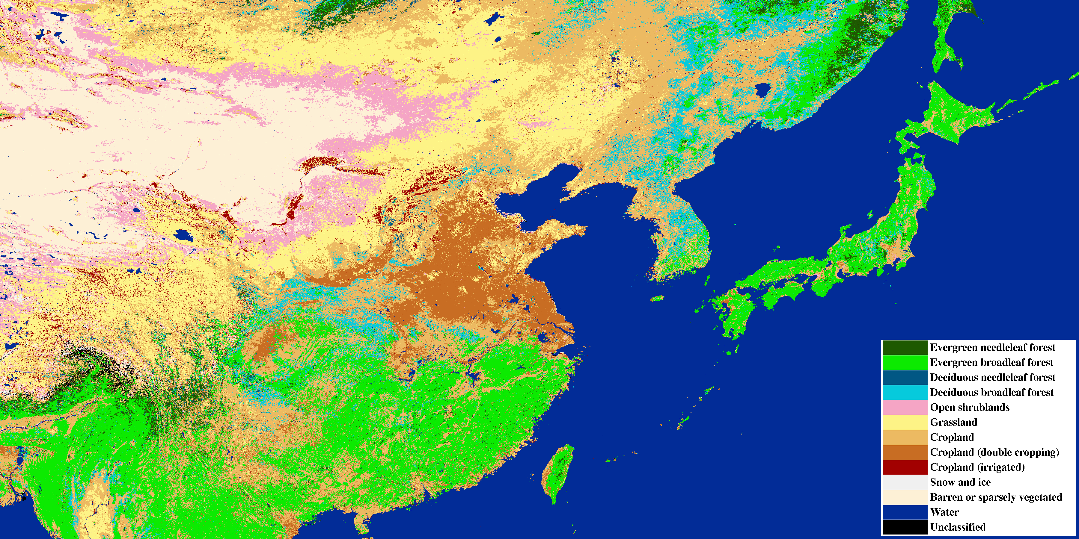
YRiS land cover classification map 2000
Reference
- M. Matsuoka, T. Hayasaka, Y. Fukushima, Y. Honda, "Land cover in East Asia classified using Terra MODIS and DMSP OLS products", International Journal of Remote Sensing, Vol. 28, No. 2, pp 221 - 248, 2007.