In the KP, to study the effects of altitude and geological substrate on plant communities, there are eight permanent study plots (0.06~1.00 ha) consisting of a matrix of four altitudes (700, 1,700, 2,700, and 3,100 m a.s.l.) and two types of substrates (non-ultrabasic and ultrabasic substrates). The climate is humid tropical with little yearly variation. Mean annual temperature is 27.5 �▀C at 0 m with a mean lapse rate of 0.0055 �▀C m-1. Mean annual rainfall is about 2,500 mm at 10 m, and increases with altitude probably up to ca. 2,800 m.
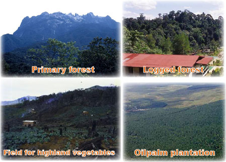
Around KP, secondary forests, swiddened fields, and fields for highland vegetables are expanding and those lands are distributed in small and patchy scale.
Deramakot Forest Reserve (DFS) is a lowland dipterocarp forest covering an area of 55,000 ha. In 1997, it was certified as a first model area of well-managed forest in
With the growing recognition that conventional industrial logging practices damage a forest drastically, alternative method, reduced impact logging (RIL), is recently introduced in
